Northbound Part 2: Makati
TO NORTHBOUND PART 1 - SUSANA HEIGHTS TO NAIAX
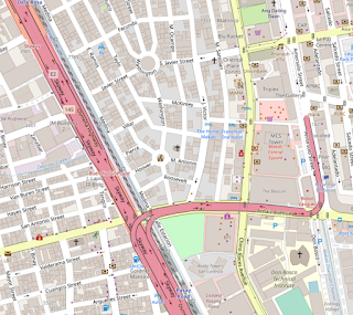
When Skyway Stage 1 and 2 were originally completed in the late 90s and early 2000s, the function of the road was akin to express lanes for SLEX - essentially allowing drivers from Alabang area to skip the congestion at the Magallanes interchange, as well as skipping 2 or 3 intersections along Osmena Highway in western Makati.
This has the rather interesting result of no exits northbound between SLEX in Alabang and (at present) NAIAX in Taguig, and then three exits in Makati that do not have a corresponding southbound exit to them! This effect is exacerbated a little bit by the opening of Skyway Stage 3, where the "outbound from Makati" direction towards Alabang now is connected to through traffic from NLEX, Quezon City, and Manila.
With that in mind, the current setup doesn't really alert drivers of anything more than the very next exit - something SMC has rectified southbound along Stage 3, but hasn't yet done much for the older segments of road. Most of the changes in my design ideas are intended to improve the level of information through this key stretch of the highway.
Exit 15, Magallanes (to Ayala, BGC, Guadalupe, Ortigas, Mall of Asia via EDSA)
14.81 kilometers/9.2 miles north of Susana Heights
Currently only labeled as "Magallanes" with no control destinations besides the district, or mention of it providing access to EDSA.
- Added Ortigas as a control destination since this is the last real practical spot for someone to go there from the south area without backtracking
- For the Don Bosco exit, added a mention of Pasong Tamo as the ramp leads to direct access to that street (and if Buendia is being referred to consistently by its old name - SMC even replaced "Gil Puyat" signage southbound with "Buendia" in early January! - same deal for what is known as Chino Roces Avenue)
- First mention of Quezon City as a control city. Though EDSA is the practical way to get to Ortigas, the Skyway is viable for most other QC destinations at this point, whether near (Santa Mesa Heights, Del Monte, Roosevelt, and Balintawak) or further off from the road (Timog Avenue, North EDSA, even Cubao to an extent).
16 kilometers/9.9 miles north of Susana Heights
Upcoming exit will be Don Bosco Street at the 17 kilometer mark, followed by Amorsolo. Following photos from me in 2019.
Exit 17A, Don Bosco (to Pasong Tamo, Pasay Road (Arnaiz Avenue), Legazpi Village, Greenbelt, Ayala)
16.8 kilometers/10.44 miles north of Susana Heights
Not an exit-only ramp so a simple downward arrow suffices. Distance to the Amorsolo ramp is measured out for context (500 meters is about 0.31 mile, a hair under 1/3rd, and in the US, a standard "exit coming up very shortly" distance is 1/4 mile, approximately 400 meters).
Exit 17B, Amorsolo Street (to Makati Cinema Square, Legazpi Village, Makati Medical Center)
17.4 kilometers/10.81 miles north of Susana Heights
Buendia exit first gets noted here.

Exit 18, Buendia (to World Trade Center Manila in Pasay/Ayala North/Salcedo Village/Poblacion)
17.94 kilometers/11.15 miles north of Susana Heights
(Due to ramp distances, this is not going to be the same exit number southbound)
Added "LAST MAKATI EXIT" text here in similar fashion to Interstate 80's "LAST SAN FRANCISCO EXIT" labeling for 4th Street in SF. (Photo below from around 2009 from me)

Part of this is to essentially let drivers know that the higher-tolled Skyway Stage 3 begins here, and that the next exit will be in the Philippines' capital of Manila!
At the Buendia Flyover (where Osmena has a diamond interchange with Buendia), there are few signs if any indicating how to get to the Skyway:
https://www.google.com/maps/@14.5579653,121.0078136,3a,75y,243.42h,92.54t/data=!3m6!1e1!3m4!1sn_T7LT_kdullHuPtwYc-Xw!2e0!7i13312!8i6656
The concept here is similar to overpass-mounted signage found near freeway/conventional road interchanges in the US:

Here's three different concepts for a sign gantry on Osmena northbound, depending on how much message loading one prefers:


Comments
Post a Comment